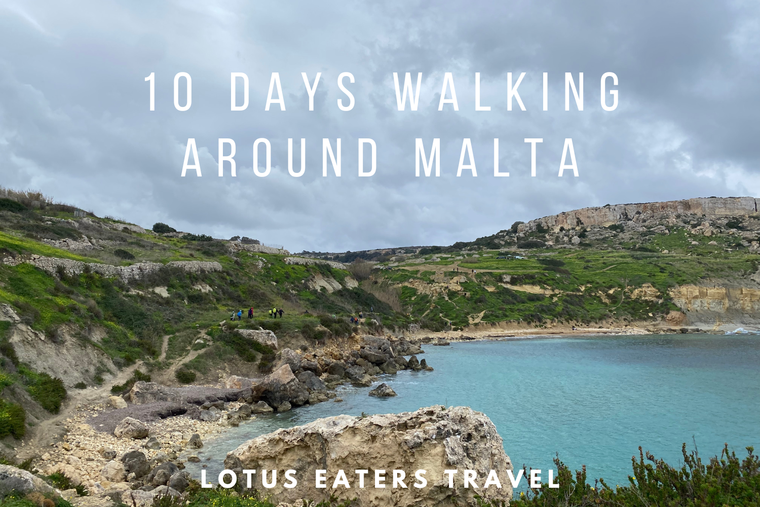
WE SPENT 10 DAYS WALKING AROUND MALTA ON THE COASTAL PATH: HERE’S OUR GUIDE.
It has long been a dream to walk the perimeter of an entire country. When we decided to visit Malta, I realised that this dream could become a reality.
Malta is of the smallest countries in the world, but let’s not dwell on that too much. During our ten days of walking we took in historic sites, scrambled up and down cliffs and delighted in pretty harbours. It was an absolute pleasure to get a chance to see Malta, one step at a time.
In this blog post, you can find our guide to the ten days we spent exploring Malta on foot. We also include maps of our route.
Alongside this guide, you may also like to read our honest review of the Malta Coastal Path as well as FAQs.


Malta & Gozo Coastal Trails eBook
If you want all the information you need in one place, why not get hold of our eBook. This book gives you 152 pages of information about the route, including daily stages guides and how to prepare.
Our daily stages on the Malta Coastal Walk
Here are the daily stages that we walked on the Malta coastal walk.
- Day 1: Valletta to Birgu 16.2km
- Day 2: Birgu to Marsakala 10km
- Day 3: Marsakala to Marsaxlokk 12.6km
- Day 4: Marsaxlokk to Zurieq 15.5km
- Day 5: Zurieq to Dingli (and then into Rabat) 14.9km
- Day 6: Dingli to Golden Sands 21.9km
- Day 7: Golden Sands to Cirkewwa 18.1km
- Day 8: Cirkewwa to St Pauls 22.7km
- Day 9: St Pauls to St Julians 16.2km
- Day 10: St Julians to Valletta 12km
Below, you can get an insight into each day on the route. We also include maps of the exact routes we took.
Day 1: Valletta to Birgu
KEY DETAILS: 16.2 kms, ascent 150m, descent 160m, time 3 -4 hours.


ROUTE
Day one took us from the capital of Malta, Valletta, to the Three Cities. This is the collective name for Vittoriosa (also known as Birgu), Senglea and Cospicua. All three are fortified cities that you can see across the water from Valletta. Vittorisosa/ Burgu is perhaps the most well known owing to the imposing Fort St Angelo.
When we set out on this route, we decided that we wanted to stick as close to the water as we could. Our idea being that this would enable us to walk as much of a “coastal trail” as possible. And, we had a quite fixed focus on walking around the entire island. For the most part, this worked well. But, walking out of Valletta and sticking to the coast is a little tricky. If I walked this route again, I might not take the same route.
Firstly, you can’t walk around the outer edges of the Valletta peninsula entirely, without paying to enter the fort. Secondly, the walk between Valetta and Birgu enters some industrial port areas – you can see on on our route map that we tried to walk into these areas, only to discover dead ends and turn back around. We also thought we would be passing two wineries on route – only to discover that they were just wine warehouses! In the end, had to walk quite a bit inland and away from the water, through the town of Il Figura.
In a way, I am pleased that we stuck to the “authentic” route. And, I did enjoy entering the historic gates of Senglea. But, I think there are better ways to enjoy this section of the route. If we did this walk again, we would walk through the centre of Valletta, see the lower and upper Barrakka gardens, then take the lift down to the dock. And, I know this is a bit unlike us, but take a boat to Birgu and not walk it! There I said it.
Honestly, I think it’s a much better way to start off the Malta coastal walk. Ironically, by not walking!
If you decide to be purists like we were, and choose to walk instead, you can find the route we took in our Komoot map above. Embrace the industrial areas and enjoy the reward of the three cities at the end of the walk.
HIGHLIGHTS


- We realized we needed a start point for the walk, so we picked a post box on Independence Square – it felt like an apt place to start and finish our walk.
- Walking around the peninsula of Valletta at the start of the walk felt like an epic way to begin our journey. Even if we couldn’t get the entire way around.
- Entering the gate into Senglea – a grand entrance to the Three Cities. We spent time relaxing by the water with coffee, then strolled to the end of the peninusla to see Gardjola Gardens and the views back to Valletta.
- A great selection of restaurants and bars in Birgu. Decent happy hour cocktails by the waterfront, followed by a €20 set menu in the centre of town.
AMENITIES
You can get anything you need in Valletta before heading out in the morning. As we walked around the coast, we also found many amenities such as road side cafes. The route takes you though the small town of Il Figura, on the outskirts of the Three Cities – here you can find refreshments, pharmacies and various shops.
ACCOMMODATION

You could choose to stay in any of the three cities. We opted for Birgu because it has the most going on in terms of restaurants and bars, plus more accommodation choices.
We stayed in a small guesthouse on Pacifiku Scicluna, aptly called 12-16 Pacifiku Scicluna. This was an ideal location in central Birgu and a quirky room – there was even a tiny hidden kitchen in the cupboard. We paid around €50 for one night.
Day 2: Birgu to Marsakala
KEY DETAILS: 10 kms, ascent 90m, descent 90m, time 2-3 hours.


ROUTE
You’re probably wondering why we chose to walk only 10kms in one day! I should mention that we decided to keep our walking days very short on this trip because we wanted to take our time exploring Malta on foot, rather than hiking at pace. As soon as I saw pictures of Marsakala, I knew I wanted to be sure to sure to have a good amount of time there to explore the area.
This said, the route is not a difficult one. It took us less than two hours to complete.
If you prefer a more challenging walk, I’d recommend combining our day two and three into one walk of around 24km. Just be sure to take time to enjoy lunch in Marsakala whilst the sun shines on the harbour. Or, if the weather permits, take a swim.
From Birgu, we took our time to explore Kalkara, with it’s pretty park, thriving square in the centre and unusual science museum. Unfortunately, we couldn’t walk close to the water, so there was a little bit of time on road. We also walked through a new build area called “Smart City” – handy for facilities but perhaps not the most picturesque.
After this, we were very pleased to finally reach a hiking trail and were able to walk close to the water. We caught our first glimpses of World War II Pillboxes and later Salt Pans, which added a bit of interest to the scenery.
HIGHLIGHTS


- Finding our first trail of the trip – glorious! And the chance to get close to the sea.
- The approach into Marsakala is very special – lovely coves and swimming spots. Before you reach the iconic church and harbour, dotted with Maltese fishing boats.
AMENITIES
Plenty of amenities in the Three Cities before leaving. We chose a local bakery (David Bakery) in Kalkara for breakfast. The SmartCity on the outskirts of Kalkara had toilet facilities, cafes and a few other shops. Marsakala has a range of restaurants, cafes and bars. We enjoyed drinks at the Sicilian cafe on the water and takeout pizzas from Bella Ciao Pizzeria.
ACCOMMODATION
In Marsalaka, there are a few hotels. We opted for Cerviola Hotel, which is a mid-size 3* hotel with a rooftop pool. As we walked off season, the pool wasn’t open but we did get a bit of a bargain at €40 including breakfast and a cheeky room upgrade.
Day 3: Marsakala to Marsaxlokk
KEY DETAILS: 12.6 kms, ascent 170m, descent 170m, time 2-3 hours.


ROUTE
A generally easy and short walk and we couldn’t fault the scenery. The trails and views out to see felt much more like the coastal walk we had signed up for than the previous days.
The area around Ta’Kalkana Sea Cave is particularly special. You’ll notice on our map that we had to double back on ourselves because we missed the turning to the peninsula – there were a few barking dogs on the corner than distracted us! I rather liked the way that we walked, because we got to tackle a nice cliff top path.
The walk just before St Peter’s Pool got a little too close to the edge of us, so we opted to duck inland before joining again near the pool. After the pool, it’s possible that you can walk around the peninsula, but we couldn’t find the path, so we looped back to the main track. The last peninsula has some points of interest, such as salt pans and Il-Kalanka lighthouse. The latter was closed for renovations, but is normally open to visitors (anyone with a British National Trust card can get free access here.)
The final stretch to the town is pretty, but for the oil refinery slightly blotting the landscape. Nevertheless, Marsaxlokk is a thriving harbour and tourist village. And, lunch by the water is a delight!
HIGHLIGHTS


- St Thomas sandy beach in the outskirts of Marsakala as we left.
- A lovely day of scenery, with walks close to the cliffs. We enjoyed taking time to visit the Ta’Kalkana Sea Cave – steps take you down to the ocean. A nice spot to take a break and soak up the sun.
- St Peter’s Pool is a popular tourist spot for swimming. It was made a little “Insta-famous” by the videos of a local dog who loves jumping into the pool.
AMENITIES
Grocery stores and cafes in Marsakala, then a few places for coffee as you get to the St Thomas Bay area. After this, Marsaxlokk has an abundance of pleasant seafood restaurants on the water – just be sure to ask the price of fish before you order it!
ACCOMMODATION
Marsaxlokk is popular with visitors and offers a range of accommodation.
We chose South Wind Guesthouse which is close to the waterfront, has a great guest review score(9.1) and offers breakfast in the room rate. Off season, we paid €60. The friendly staff also facilitated an early check in for us -all round, a lovely place.
Day 4: Marsaxlokk to Zurrieq
KEY DETAILS: 15.5 kms, ascent 190m, descent 60m, time 3-4 hours.


ROUTE
This section of the route is not the Pièce de résistance of the Malta coastal walk. My notes from this day simply read “terrible walking – industrial.” And, that just about captures it.
In truth, it’s a little more nuanced than that. The walk out of Marsaxlokk is pleasant and easy. With the Forti San Lucjan area a particular highlight. Birzebugga is a small town on the water with pleasant places to pause for coffee or a break. There’s also a pretty bay and a few points of interest, like the memorial which marks the end of the cold war.
It is after this point that things to get a little worse. The walk is forced away from the water and heads inland to Zurrieq through industrial zones. Zurrieq itself is a quirky town with a pretty church and local bars – they seem like intimidating sorts of places but are very friendly. After a few drinks we took a beeline for the takeout pizza from Tal-Pjazza Take Away.
HIGHLIGHTS
- The initial walk out of town and into Birzebugga. As well as the paths around Forti San Lucjan.
AMENITIES
Groceries and cafes found in Marsaxlokk, followed by a few amenities in Birzebugga. Finally, restaurants and cafes in Zurrieq.
ACCOMMODATION
Zurrieq is not really a tourist town. We found a room in a private property and whilst we enjoyed the town, the accommodation was far from ideal.
If we were doing this walk again, I would take one of three options:
1/ Skip a section of this walk, using public transport, and merge it with Day 5 to get to Dingli by the end of day 4. Or, walk the full 30km distance in one day.
2/ Stay outside of Zurrieq towards the Blue Grotto area – ideal if you can get a booking at the Deep Blu Boutique Hotel.
3/ Walk to Zurrieq and take a 15 minute bus back to Marsaxlokk, where accommodation is better. This option also means you can be blissfully luggage free for a day!
Day 5: Zurrieq to Dingli (and then into Rabat)
KEY DETAILS: 14.9 kms, ascent 130m, descent 120m, time 4-5 hours.


ROUTE
If the previous days hiking was a disappointment, today was quite the opposite. This is probably the most famous hiking section in Malta – the walk from Blue Grotto to Dingli. In context, Dingli cliffs are the highest point of Malta. There are various viewpoints from which you can see the 250m high cliffs.
From Zurrieq, the walk follows road before offering views to the famous Blue Grotto (cave). After this, you’ll reach Hagar Qim Temple – a grand neotlithic temple. Although the walk actually goes through the site, you can’t see the temples unless you buy a ticket. Well worth if if you are into history and have time to spare.
The path is a little fiddly to get past the temple and down to the cliffs. You have to enter the temple car park, then head up through the site before taking a left before the second temple to follow the cliff. This should be well marked on our map.
The route down the cliffs is quite steep and does require a bit of technical ability (or willingness to skoot down on your bottom!) It felt quite a safe walk, albeit a little scary owing to the steep drops. Perhaps one of the hardest sections is found just before Ghar Lapsie Divesite. Surefootedness is required and it’s best to take this section carefully.
The divesite is quite pretty and it’s popular to swim in the shallow water by the caves in summer. There are cafes here to stop for a drink or a bite.
The second part of the hike from the divesite onward is quite straightforward and the area around Dingli feels quite safe. The scenery is remarkable but the walking is not technical or difficult. In fact, sections of it after the cliffs are on road. It felt a little odd to arrive here and see so many walkers.
After the cliffs, take time to enjoy the views and see the chapel further up the road. We recommend visiting and staying in Rabat at the end of this day. You can walk an extra 3km or so on road or take an easy bus from the cliffs or Dingli town.
HIGHLIGHTS


- Fantastic, rugged and challenging walking after Hagar Qim Temple
- I enjoyed spending a while seeing Ghar Lapsie Divesite and petting the friendly cats who frequent the area.
- Incredible scenery at Dingli cliffs, albeit busy with many visitors.
AMENITIES
Cafes and restaurants found at Ghar Lapsie Divesite. You’ll find amenities in Dingli town or further on in Rabat if you continue there.
ACCOMMODATION
Dingli is a famous area for the cliffs, but Dingli town itself is not really a tourist area. That said, Dingli is very close to the wonderful connected towns of Rabat and Mdina.
Mdina is the former capital of Malta and a very pretty place to walka round. Rabat is a bit of a trendy town with great food. For this reason, we chose to head inland after our walk and stay in Rabat – taking an extra day to enjoy the towns.
There’s a wide range of accommodation in Rabat. We opted for My Travel House – a pretty guesthouse in the heart of Rabat with a great breakfast offering.
Day 6: Dingli to Golden Sands
KEY DETAILS: 18.9 kms, ascent 390m, descent 610m, time 5-6 hours.


ROUTE
This was perhaps one of the most challenging sections of the route, in part because we there were two places where it was tricky to find the way through. There are also some steep sections – both up and down.
We started by taking the bus from Rabat back to Dingli to return to the trail. From here, there was a little road walking before reaching a section closer to the water. For us, this day was extremely muddy as there had been rain for two days before. If it is muddy, it may be best to find routes inland on pavement/ road rather than the footpaths shown in our map.
Where to route gets a little tricky is around the Ghajn Hamiem hiking area. Our initial plan was to cut across this peninsula but we were met with various sign posts indicating “no entry” and “private land”. Instead, we tried to walk around the peninsula, sticking to the hiking area that we assumed would be public land. There were still a few “private land” notices, but there were other hikers in the area so we continued. It felt for a long time like there was now way down, but eventually we found the way to descend (close to the north west of the peninsula) – shown below.

After this, the path leads down easily to Gjenja beach. We walked around this bay, then continued until reaching Ta’ Lippija hiking area. The hike up the bank here is very steep, we nearly gave up and turned back. After a steep climb, there is a rocky section requiring a little bit of scrambling to arrive to the top.
The final section took us down to Golden Bay, with a bit of a steep climb down. Perhaps made worse by muddy conditions. On a normal day, the path would feel much more accessible.
HIGHLIGHTS

- Spectacular scenery throughout the day, in particular around Ghajn Hamiem hiking area.
- Series of coves towards the end of the walk – a chance to swim if the weather is fine.
- I must admit that getting to our hotel and enjoying the spa facilities was a highlight for me.
AMENITIES
There are amenities in Dingli town. After this, there are some beach kiosks at Gjenja beach. I’d recommend packing lunch and refreshments with you as these kiosks are close to the end. In Golden Sands, you’ll find a coffee kiosk and a restaurant, as well as the large hotel.
ACCOMMODATION


Golden Sands is a beach resort, dominated by the 5* Raddison Blue Hotel. As we were visiting off-season we got a great deal and decided to treat ourselves a bit. Anyone who follows this blog, will know that we aren’t really 5* hotel kind of people. But on this occasion we thought we should give it a go.
The hotel is great and we lapped up the free fizz with breakfast and luxuriated in the spa facilities. That said, I was a tad embarrassed showing up to check in covered in mud from a day of hiking!
If you’re on a budget, or just don’t fancy staying here, I’d recommend taking a bus to either St Paul’s Bay or Mellieħa Heights – both have plentiful accommodation and restaurants/bars.
Day 7: Golden Sands to Cirkewwa
KEY DETAILS: 21.9 kms, ascent 520m, descent 720m, time 5-6 hours.


ROUTE
The route starts in a National Park area, popular with other hikers. This was really enjoyable walking for us and felt like one of the first opportunities to just walk without looking too closely at the map.
After this, the walk reaches Popeye village – a film set which is now a theme park. We had hoped to continue behind the theme park to reach the cliffs, but unfortunately public access has been blocked off. From Popeye village, we walked towards the main road, before walking alongside this road for sometime. From here, you have two choices – continue to get to the port. Or, you can cut left towards the Red Fort, then back down to the coast and along. Shown in the map.
HIGHLIGHTS
- Il-Majjistral Natural and history park at the start of the walk – wonderful scenery
- The Red Fort dominates the landscape – we had seen it in the distance and it was nice to walk past.
AMENITIES
There were no amenities on route until the end, but if you needed something you could easily cut to the various cafes around Ghadira.
ACCOMMODATION
We took the ferry to Gozo at this point to commence our three day Gozo island walk. If you are doing the same, then this is the best time to hop on the ferry and cross to the smaller island.
If you’re not going to Gozo, there are a few hotels near to the port. For example, the Riviera Spa Resort. You can also take a bus to Mellieħa Heights, which offers more of a vibe for the evening. Sticklers wishing to do the entire route, can return to the port by bus in the morning to re-commence the route.
Day 8: Cirkewwa to St Paul’s
KEY DETAILS: 22.7 kms, ascent 280m, descent 260m, time 6-7 hours.


ROUTE
The first 8km or so take you around the Northernmost peninsula of Malta, the area known as L-Ahrax and L-Armier. It is a relatively flat area dotted with a campsites and a few other points of interest – such as the Coral Cave and White Tower. There are sections of this area that are popular for shooting, so look out for signs if you visit in shooting season.
After this, the route weaves back towards the main roads and busy area around Mellieha. We took the chance to stop for coffee and watch the windsurfers in Ghadira Bay.
The second half of the hike is much more exciting, with challenging footpaths going around the headland and offering views of St Paul’s Island. This area is undulating and very beautiful. A final climb up Simar Nature Reserve awaits, before entering the hubbub of the St Paul’s area.
HIGHLIGHTS


- Views out to St Paul’s island and challenging hiking around Mistra.
- Arriving to St Paul’s for some drinks and letting loose a little.
AMENITIES
A few cafes around L-Armier then Ghadira Bay, with an option to go up to Mellieha heights for more amenities. St Paul’s is a large town catering to locals and tourists – there are lots of bars and restaurants.
ACCOMMODATION
St Paul’s is an absolute treat for anyone who loves a hotel bargain. It is one of the largest and most popular holiday resorts on the island and accommodation choice is plentiful.
We opted for the Mayflower Hotel – bagging a €30 room for the night. An extra €10 or so will include breakfast. We mistakenly thought we had breakfast included and turned up at 07:00 expecting it – only to be told it wasn’t include in our rate. Oops!
Day 9: St Paul’s to St Julian’s


KEY DETAILS: 14.9 kms, ascent 130m, descent 120m, time 4-5 hours.
ROUTE
The walk around St Paul’s peninsula is rather pleasant, with a chance to stop at the charming Promenade Cafe for various sweet things to set us on our way. After leaving the peninsula, there’s a small section of nature reserve. Then a few hundred metres through a bird watching area. Before the route forces you to walk alongside a busy road on a path. This continues for some time, before reaching a handful of restaurants and bars in the Naxxar area.
After this point, the walk becomes a bit more attractive as it follows the headland towards Pembroke nature reserve area. The last section passes military training areas before reaching the sprawling metropolis of St Julian’s.
HIGHLIGHTS


- Pleasant walking around the St Paul’s peninsula
- We walked on a sunny day and took the chance to stop for icecream in Naxxar
- The section around Pembroke and the nature reserve are pretty
AMENITIES
There are plenty of amenities in St Paul’s as you leave, then a small group of cafes in Naxxar. St Julian’s offers all the amenities you could possibly want.
ACCOMMODATION
St Julian’s is similar to St Paul’s – very much a holiday friendly area. Accommodation is reasonably priced and easy to come by.
We opted for the Antoniel Suites. Whilst not our favourite hotel on the trip, it was sufficient for the evening and a good price.
If St Julian’s isn’t your cup of tea, nearby Silema is a little quieter. It would also be possible to walk from St Paul’s to Valletta in one day if you’d rather reach the capital sooner.
Day 10: St Julian’s to Valletta
KEY DETAILS: 12 kms, ascent 140m, descent 130m, time 3-4 hours.


ROUTE
A very easy walk, closer to a waterside stroll than a hike. The route takes you around the peninsula of St Julian’s, before seamlessly leading to Silema. From here, you can see Valletta opposite, then continue to follow the water through Gwardamanġa . We chose to walk through a park on the outskirts of Valletta, before visiting Argotti Gardens and then entering the city.
If you wanted to, you could take a boat from Silema into Valletta. The walk is pleasant enough, but there may be something quite special about finishing up by boat.
HIGHLIGHTS

- Views out to Valetta from Silema.
- Entering through the historic gates of Valletta knowing that we had walked around the whole island.
- Finishing back at the post box on Independence Square.
AMENITIES
You’re never far from amenities on today’s route as the path follows the coast through Silema and then into the outskirts of Valletta.
ACCOMMODATION
As the capital, Valletta has a wide range of accommodation options – from luxe hotels to small guesthouses.
We stayed in a few different places, but in the end our preferred hotel was The Capital Boutique Hotel. A great location, lovely little hotel bar and smashing breakfast.
Written by Emma
Wine Lover. Yogi. Hiker. Writer.


Cyprus or Malta: a deep dive into the two islands
CYPRUS OR MALTA: A DEEP DIVE INTO THE TWO ISLANDS. Golden stone cities, azure seas, and a long, tangled web of Mediterranean culture and history – both Malta and Cyprus tick so many boxes when it comes to sunshine escapes. They’re warm, safe, culturally rich, and surprisingly affordable. But if you only have time for…
St Paul’s Bay vs St Julian’s Bay Malta: which coastal town to choose?
ST PAUL’S BAY VERSUS JULIAN’S BAY: WHICH COASTAL TOWN TO CHOOSE? Malta’s coastline is all cliffs, coves, and flashes of blue. Dotted along it are bays and towns that each have their own pace and rhythm. Two of the most talked-about spots, St Paul’s Bay and St Julian’s Bay, both pull in visitors, but for…
15 best hikes in Europe for April
15 BEST HIKES IN EUROPE FOR APRIL. April is a wonderful month to enjoy hiking in Europe, whether you’re looking for a long distance trail or a few days of trekking. But, you have to pick wisely to find the best hiking weather. In the north, trails might still be snowbound. But head a little…
USEFUL LINKS FOR FLIGHTS, ACCOMMODATION AND TRANSPORT


CHECK LATEST FLIGHTS
ACTIVITIES TO CONSIDER
FOLLOW US ON SOCIAL MEDIA
Please note that some links on our website are partnered with affiliates. Using an affiliate links does not make it more expensive for you to purchase. We receive a small commission whenever you buy something which in turn allows us to keep writing independent travel guides and your support is greatly appreciated.
One response to “10 days walking around Malta: our guide with maps”
[…] spent 18 wonderful days exploring Malta on foot, we walked the perimeter of both Malta and Gozo on coastal trails. As well as spending time inland […]