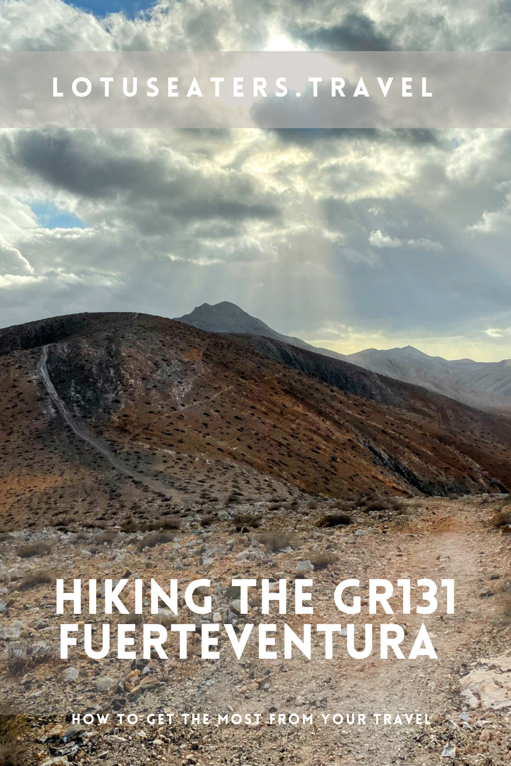
GUIDE TO HIKING IN FUERTEVENTURA: THE GR131 FUERTEVENTURA. THE CAMINO NATURAL DE FUERTEVENTURA.
We decided to kick off our 2024 hiking season with a bang and walk the GR131, a long distance trail which crosses seven of the Canary Islands. Fuetreventura, one of the largest of the Canary Islands was undoubtedly one of the best bits of the whole trail.
This blog post sets out everything you need to know about hiking the GR131 in Fuerteventura, including daily stages, refreshments and accommodation.
You may also want to read this alongside our GR131 Canary Islands FAQs post – found here.
What is the GR131 in Fuerteventura?
This blog post focuses on the GR131 in Fuerteventura which we recently walked. The GR131 is a long distance hiking path that runs through seven of the Canary Islands, mostly coast to coast.
It is often referred to as an “island hopping” trail, because you need to take ferries to move between the seven different islands. The GR131 on Fuerteventura is also called the Camino Natural de Fuerteventura.
How long is the GR131 Fuerteventura?
The GR131 Fuerteventura is 164km or just over 100miles from the start of the trail to the end.
How many days does it take to walk the GR131 Fuerteventura?

The Cicerone guide to the GR131 recommends nine days, averaging around 18km per day.
We walked the route in six days with an average of 23km per day, however we chose to cut some parts of the route a little short.
If you are walking only the GR131 on Fuerteventura then we would recommend completing the entire route, however if you are short on time or you are walking the GR131 on other islands then you may also benefit from trimming the route a little.
Here’s how we did that:
Firstly, the full route starts on Isla de Lobos, a tiny Island just North of Fuerteventura. If you decide to walk the GR131 around this island, then you will most likely need a full day to allow for the boat between the islands and the hike.
Secondly, the GR131 trail ends at Faro Punta de Jandia, at the very South Western tip of Fuerteventura. This requires an additional day of walking past Morro Jable port, from which you can take the ferry to the next island.
What is accommodation like on the GR131 Fuerteventura?
The GR131 starts and ends in busy beach resorts, where hotels are easy to find. It travels through a few smaller towns and villages, where you can get accommodation. However, there are long stretches with nowhere to stay and therefore camping is a great option for those wanting to hike the entire GR131 on Fuetreventura.
We recommend booking accommodation ahead and planning your route carefully, if you do wish to rely on hotels rather than camping. We provide recommendations for hotels in the daily stages summary below in this post.
Can you camp on the GR131 in Fuerteventura?

Wild camping is prohibited on the Canary Islands. That said, many choose to wild camp when walking the GR131. This is because accommodation can be expensive on the islands and is often not conveniently located near to the trails. There are parts of the GR131 where there is little choice but to wild camp, as accommodation is sparse.
From our research, we are not aware of anyone who has had any trouble wild camping throughout the Canaries on the GR131. So long as you stick to simple rules – leaving no trace, no fire, camping away from the trail, avoiding private land and finally pitching at dusk and packing up at dawn.
It is not always easy to find a perfect wild camping spot due to the topography of the islands. However, in Fuerteventura, we found it relatively straightforward to find a decent camping spot on flat ground.
There are a number of trail shelters on the GR131 and we tended to find decent camping spots near to these – this seemed to be a popular option as we met a few other hikers camping there too.
How to get to the start of the GR131 Fuerteventura?


The GR131 starts in Corralejo in Fuerteventura. Handily, this is the port town that you will arrive into if you take the ferry from Lanzarote. Should you be arriving by air, you will need to take a bus or cab to Corralejo.
You can find our guide to taking the ferry in the Canary Islands here.
Where does the GR131 Fuerteventura end?

The GR131 on Fuerteventura ends at Faro Punta de Jandia in the very South of the island. However, many choose to end the route in Marro del Jable, which is a port town with ferries to Gran Canaria.


We used the app All Trails to navigate the GR131 throughout the Canary Islands – this is a great app, with an offline function that helps you to ensure that you stay on the route. It also has a great function showing the altitude and helping you to track distances to and from towns.
You do need to pay for the app, a yearly subscription – but we think it’s well worth it if you are planning to walk the GR131.
In addition to using a GPS map like All Trails, you will find red and white trail markers along the GR131. Each island uses slightly different sign posts and markings, but the red/ white is consistent. In our experience, Fuetreventura is fairly well sign posted, but we often found that the distances on the signs were incorrect.
Where to get food and refreshments on the GR131 Fuerteventura?
The GR131 on Fuerteventura goes through a number of towns and villages, normally at least one per day. Bars, cafes, restaurants and mini-markets provide the best opportunities to get refreshments.
We recommend planning ahead to ensure that you have enough supplies, especially water. You can find details on the amenities on route on our daily stages guide below.
Is the GR131 Fuerteventura hard?

We would describe the GR131 as a medium to challenging hike. It requires sure footing and an ability to tolerate steep ascents and tough descents.
Due to the Canary Islands’ topography, there are many changes elevation, narrow paths, and challenging sections, particularly in areas with steep slopes or loose ground.
The GR131 Fuetreventura is probably one of the easiest sections, with less hill climbs than other islands. However, it is the longest section. One of the biggest challenges we found was walking through sand in the desert areas.
What is the terrain like on the GR131 Fuerteventura?

The terrain is mixed on the GR131 on Fuetreventura. You’ll encounter a large desert expanse, pine forests, coastal walking and mountain sections too. It was one of our favourite islands to hike on the route as it is so varied and kept surprising us!
What to pack to walk the GR131 in Fuerteventura?
You can find our full packing list for the GR131 in our GR131 Canary Islands FAQ’s and planning post here.
GR131 Fuerteventura Daily Stages
We walked six days and the majority of the GR131 on Fuerteventura and aimed to average around 23km per day.
As we were wild camping, we often stopped short of towns in the evening – this is a good tactic to avoid camping in built up areas but also to allow us to get coffee and breakfast as soon as possible in the morning!
Depending on your accommodation preferences and walking paces, you will need to plan and tailor your daily stages carefully – but we share ours below, which we hope will help to give you a sense of the route and to help you plan your adventure.
Day One: Corralejo to La Oliva


KEY DETAILS: 22km/ 14 Miles, 1300ft Ascent, 6/7 HOURS.
ROUTE:
The route starts with an initial climb out of the busy town of Corralejo along pavement. After a km or so, you will reach a gravel road where the trail begins.
There are normally many hikers around who have come to visit the famous Calderon Hondo in this area. Calderas are essentially large holes that have been created by eruptions of volcanoes. The GR131 does not directly climb to Calderon Hondo, but you can come off the route (very slightly) to see the incredible phenomenon.
Around Caledron Hondo and just before Lajares, you will also be presented with an option to walk a shorter route, choosing either a right or left turn.
We opted for the shorter route (3km less than the longer option) and expected it to be steep, but it was completely flat and easy walking.
After Lajares, there is an ascent, with views back to the coast. Look out for birds of prey on parts of the route today, you may see buzzards, finches and stonechats around the volcanic formations.
AMENITIES:
Corralejo town has many amenities, from cafes and restaurants to large supermarkets. There are also quite a few clothing and apparel stores, should you need anything.
Aroud 10 km into the route, Lajares is a small surf town that has a number of cafes close to the trail and a supermarket around 10 minutes away from the trail. We really liked La Central cafe for coffee and smoothies.
La Oliva is a charming town with a bit more in terms of amenities, cafes, a mini-market and a pharmacy too.
ACCOMMODATION:
Accommodation in Corrajelo is easy to come by, ideally you will want to be located centrally and close to the port and the start of the trail. For budget travellers, Nomad Surf House is a good choice, others may prefer Labranda Corralejo Village.
For accommodation at the end of the day, there are options in Lajares and La Oliva . We located a nice camp spot around 3km short of La Oliva and near to a trail shelter.
Day Two: La Oliva to Tefia


KEY DETAILS: 18km/11miles, 400ft Ascent, 5 hours.
ROUTE:
After La Oliva, the route is on a trail. The majority is on a large dirt track across a stony desert area.
We noticed a few sections of the trail that followed quite convoluted routes – where possible, we took alternate footpaths to cut these unnecessary corners. The route also passes the impressive Montana Tindaya, which can be seen for much of the day.
In Tefia, look out for the small agricultural museum which you can visit if you wish to. There are also some large windmills displayed on the route, the most interesting of which is Molino de Tefia – a sign of the farming history of the area.
AMENITIES:
Tindaya is a small town with one cafe, a cheese shop and a mini-market.We had heard there was a cafe in the Museum in Tefia, but it didn’t seem to exist when we were there.
ACCOMMODATION:
There is very little in Tindaya and Tefia, but a few rural hotels can be found on Booking.com. There’s also a Youth Hostel just outside Tefia, we think it can be booked by contacting them directly. We took a camping spot just past Tefia in the vicinity of a mountain shelter.
Day Three: Tefia to El Pinar


KEY DETAILS: 19km/ 12 Miles, 1700ft Ascent, 7 hours
ROUTE:
The route starts quite flat with a long stroll into Llanos Concepion, then arriving at the prettier village of Valle de Santa Ines after a few more kms. After this, switch backs take you on a steep climb up a mountain gap.
At the top of the hill is a popular Mirador, with many driving or cycling to reach it. Views from here are splendid as you look back across the hill you’ve just climbed.
There are two giant statues to Ayosa and Guise representing historical rulers of this area. After this, an easy path leads downhill to Bentacuria, the oldest town in Fuerteventura and a popular tourist destination.
Many will choose to stay in Bentacuria, but after lunch we were keen to get a little more distance. After Bentacuria, is a wonderful climb to Moro Jable.
A tough and steep ascent leads to out of this world views from either side of the path. Eventually the ridge leads downwards into El Pilar park, where we found a camping spot.
AMENITIES:
Llanos de la Concepion is the first village you will come across with amenities. There is one bar which serves delicious sandwiches for breakfast. If you can wait a little longer, Valle de Santa Ines is a really charming village a few more kms away and offers some cafes with pleasant views and a small mini-market.
Bentacuria is the biggest town on the route – a pretty place and popular tourist spot. There are a few restaurants, all very lovely but a little expensive. Unfortunately there are no grocery stores, just souvenir shops but they sell ice-cream and water.
El Pinar has a recreation area which has toilets and water (not drinkable), as well as BBQ facilities.
ACCOMMODATION:
Bentacuria is the largest town you will pass today and a good place to find accommodation – check availability on Booking.com here. We opted to camp in El Pinar near to a recreation area, which had access to a toilet block.
Day Four: El Pinar to Cardon

KEY DETAILS: 26km/ 16miles, 1750 ft Ascent, 7 hours.
ROUTE:
An initial climb took us to a flat road towards a village, before we reached another steep climb with switch backs. A flat river bed leads to Pajara town.
After Pajara for lunch the trail becomes quite tough as it enters the rugged mountains. If the weather looks shaky or you don’t have much day light left at this point, we recommend remaining in Pajara.
This was one of the most challenging sections of the route with steep climbs, narrow paths, some clambering and steep drops.
AMENITIES:
Between El Pinar and Pajara there are a couple of cafes and restaurants, Don Antoni and Casa Naturaleza (both owned by the same people). Unfortunately we found them both to be closed. The opening times listed on Google were not accurate.
Pajara is a larger town with a handful of restaurants/ bars and a large Spar supermarket. We had lunch in the local Cafe Deportes and really enjoyed it.
ACCOMMODATION:
Pajara has a couple of hotels that can be found here on booking.com. After this, there is no accommodation until La Pared (a further 26km away.) It may be possible to arrange a taxi from Cardon to accommodation elsewhere if needed.
Do note, if you are camping that the terrain gets a little wild today after Pajara as you climb into mountains – camping spots are not easy to come by until you come down to lower altitude. We camped a few kms short of Cardon, there’s also a mountain shelter around 1km short of the town.
Day Five: Cardon to El Jable


KEY DETAILS: 26km/ 16 miles, 1000ft, 6 hours
ROUTE:
The route starts easily, but after Cardon we were a little confused by some of the sign posts and resorted to using our All Trails map. Industrial roads lead past a goat farm and eventually reaches La Pared. If you want to visit the beach, there’s a chance to take a detour onto a footpath down to the coast.
After La Pared, the route becomes quite exciting as it enters desert landscapes of El Jable. It was an out of this world experience and we loved walking in this area, albeit the sand was difficult under foot at times.
AMENITIES:
Cardon has a bar, which we found to be unexpectedly shut. However, the mini-market was open and serves delicious coffee. Between Cardon and La Pared, a goats cheese farm shop can be found but nothing else.
La Pared has one bar, which is sadly very overpriced for food and run by quite a grumpy owner so we wouldn’t fully recommend it! There is however, a lovely mini-market selling some nice fresh produce and Italian bits.
ACCOMMODATION:
La Pared has one hotel, found here. This is the last chance for accommodation until Morro Jable.
For camping, we walked a few kms past La Pared to find a quiet spot in the desert. An easy area to locate flat ground, but it can be windy.
Day Six: El Jable to Morro del Jable


KEY DETAILS: 22km/ 14miles, 750ft Ascent, 5 hours
ROUTE:
Once leaving the desert, the route follows a road before crossing it and switching back to the opposite direction. We missed the turning here as it is not easy to see. Soon, the coast comes into sight and it is absolutely beautiful.
The rest of the day seemed to vary between walking directly on the beach and foot paths, we were never fully sure if we were on the GR 131 or making up our own route. But it was pleasant nonetheless. Lots of opportunities to swim or relax on the beach should you want to.
AMENITIES:
The first place for refreshments you’ll reach after leaving the desert is Tierra Dorada beach bar. This does not serve food early in the morning and is a little overpriced. After this, the town of Esquinzo has plenty of choice, including supermarkets. You’ll notice lots of beach bars along the coast before reaching Morro del Jable, which has plenty of amenities.
ACCOMMODATION:
Morro del Jable is a beach town popular with tourists, subsequently hotels are readily available. Booking in advance is advised. Find a hotel in Morro del Jable here.
(Optional) Day Seven: Morro del Jable to Faro Punta de Jandia
If you are continuing on to Faro Punta de Jandia, then this will take an extra day. From Faro Punta de Jandia, you will need to take a bus to return to Morro Jable if you plan to take a boat to Gran Canaria to continue to the GR131.
Find out more about transport between the islands here and about walking the GR131 in Gran Canaria here.
Where to next on the GR131?
The GR131 is a long-distance island hopping route. Find all our resource for the GR131 here:
- GR131 Planning – all you need to know to prepare
- GR131 Fuerteventura
- GR131 La Gomera
- GR131 + GR132 – a circular hike in La Gomera
- GR131 Gran Canaria
Written by Emma
Wine Lover. Yogi. Hiker. Writer.


Join our subscriber list for new posts with awesome travel tips. Don’t miss them!
Subscribe below to our newsletter for tips, thru hiking, adventures and insights to places unseen.
Canary Islands in January: what to expect
CANARY ISLANDS IN JANUARY: WHAT TO EXPECT. I make no secret of how much I love a bit of winter sun, or indeed the Canary Islands. Having visited several times in both the shoulder and peak seasons, I was curious to see what they were like in winter, when much of Europe is huddled under…
15 best hikes in Europe for April
15 BEST HIKES IN EUROPE FOR APRIL. April is a wonderful month to enjoy hiking in Europe, whether you’re looking for a long distance trail or a few days of trekking. But, you have to pick wisely to find the best hiking weather. In the north, trails might still be snowbound. But head a little…
10 Hiking Routes in Europe for December: chasing the sun
10 HIKING ROUTES IN EUROPE FOR DECEMBER: CHASING THE SUN. Late last December, we set out to walk the Fisherman’s Trail. A long distance hiking trail that wraps around the very south western point of Portugal and takes in the best of the Algarve. Not a day went by when we didn’t pinch ourselves, feeling…
USEFUL LINKS FOR FLIGHTS, ACCOMMODATION AND TRANSPORT


FOLLOW US ON SOCIAL MEDIA
Please note that some links on our website are partnered with affiliates. Using an affiliate links does not make it more expensive for you to purchase. We receive a small commission whenever you buy something which in turn allows us to keep writing independent travel guides and your support is greatly appreciated.
2 responses to “Guide to hiking in Fuerteventura: The GR131 Fuerteventura”
[…] Fuerteventura […]
[…] recently walked the GR131 through Fuerteventura, visiting the entire island in the process. We were absolutely blown away by how beautiful it was […]