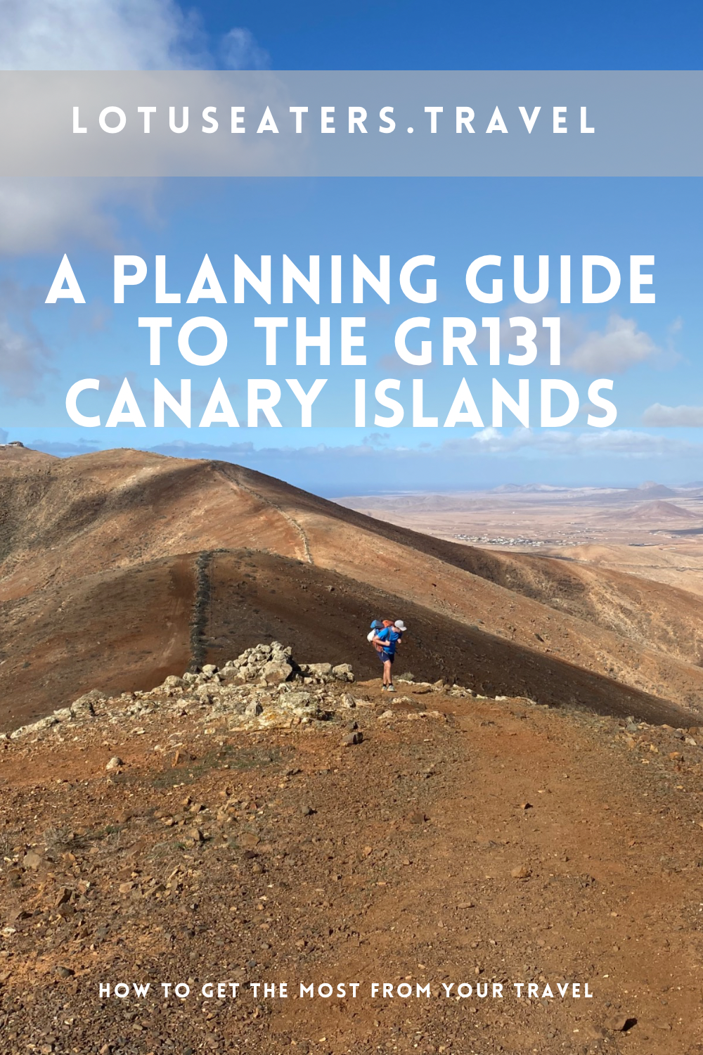
HOW TO WALK THE INCREDIBLE GR131 ACROSS THE CANARY ISLANDS. A PLANNING GUIDE.
We recently walked the GR131, a long distance trail that spans seven of the Canary Islands. From volcanoes to national parks, tropical beaches and palm trees, this long-distance hike has quickly become a firm favorite for Lotus Eaters Travel.
Before we walked the GR131, we had a vast number of questions. Here in this blog post, we have put together a planning guide to help you get the most from your travel through the Canary Islands on the GR131.
This blog aims to cover all the key questions, about accommodation, camping, food and water as well as the hiking terrain.
We also have daily stages guides to each of the islands that we walked, found here.
How long is the GR131?
The GR131 starts in Lanzarote and stretches through seven of the Canary Islands to El Hierro. It is widely accepted to be 560km or 348 miles.
How many days does it take to walk the entire GR131?
The number of days required to walk the GR131 depends on a few factors.
Firstly, your walking pace is an important factor. Secondly, your choice of accommodation – specifically, if you choose not to wild camp there are some islands where you will need to move off the trail to find accommodation which will increase the amount of time you need.
Finally, you will need to factor in ferry transfers between islands and some juggling of buses to get to the start of the trails or from the trail to the port.
That said, here’s a rough guide for the number of days required to walk each island and the entire trail.
| Island | Distance (approx) | Days Required |
| Lanzarote | 73km | 4 to 7 (we took 4) |
| Fuerteventura | 164km | 6 to 9 (we took 6.5) |
| Gran Canaria | 74km | 3 to 5 (we took 3.5) |
| Tenerife | 94km | 5 to 7 (we took 6) |
| La Gomera | 45km | 2 to 3 (we took a leisurely 3) |
| La Palma | 70km | 4 to 5 |
| El Hierro | 40km | 2 (or a very leisurely 3) |
In addition, you’ll need to factor in time for transfers from one island to another. You can see our rough guide to travel from port to port and port to trail below.
Which direction should I walk the GR131?
Traditionally, the GR131 is walked East to West starting with Lanzarote and ending with El Hierro. However, it is possible to start with the smaller islands near to Tenerife (El Hierro, La Gomera and La Palma) and then work your way towards Lanzarote afterwards. However, if you opt to do this, you would need to walk each trail backwards too.
Which is the best island to walk on the GR131?
Each island on the GR131 is completely different and it would be hard to pick just one for us. Our personal favourite island to walk on the GR131 was Gran Canaria, because it offered such variety day to day. But, Fuerteventura was also spectacular when it comes to beaches and scenery. Anyone with less time to walk, may enjoy La Gomera – a shorter trail, which could be combined with the GR133 to create a circular trail.
You can read our detailed guides for each island here to help you choose, but if we had to categorize each island – we would say:

Lanzarote
For volcanic scenery and solitude.

For beautiful beaches, breathtaking scenery and ease of camping.

For hill lovers and varied terrain.

Tenerife
For pine forests and Teide National Park.

To meet other hikers and for tropical terrain.

La Palma
For hardcore hikers.

El Hierro
For remoteness and tranquility.
How to find transport between each of the Canary islands

The best way to get between the Canary islands is to take a ferry – it is possible to fly between some of the islands too (for us this didn’t quite fit the spirit of the trail, so we stuck to the boat.) You can find our short guide to the ferries between the islands on the GR131 below.
| From and To | Transport | To note |
| Lanzarote to Fuerteventura | Ferry from Playa Blanca to Corralejo – Fred Olsen, Lineas Romero and Armas. The ferry takes between 25 and 40 minutes. | One of the easiest transfers, a short ferry ride and direct from trail to trail with no requirement for buses. |
| Fuerteventura to Gran Canaria | Ferry from Morro Jable to Las Palmas. Route operated by Fred Olsen and takes around 120 minutes. | Morro Jable is directly on the route. In Gran Canaria, you will need to take a bus from Las Palmas to Maspalomas in the south of theisland to start the GR131. |
| Gran Canaria to Tenerife | Ferry from Agaete to Santa Cruz de Tenerife. It takes around 90 minutes and is operated by Fred Olsen. | Agaete is directly on the GR131 route. The GR131 in Tenerife starts inland so you will need to take two buses to get to the start from Santa Cruz de Tenerife. |
| Tenerife to La Gomera | Ferry from Los Cristianos to San Sebastian de La Gomera takes 50 minutes and is operated by Fred Olsen. | At the end of the trail in Tenerife, you will need to take a short bus to Los Cristianos. The trail in La Gomera starts from the port in San Sebastian. |
| La Gomera to La Palma | Ferry from San Sebastian La Gomera goes back to Los Cristianos in Tenerife, from there you can transfer to La Palma (you can sometimes stay on the same ferry.) Both ferries are operated by Fred Olsen. | Time taken depends on the connection of the ferries. The GR131 in La Gomera ends in Vallehermoso and you will need to take a bus back to the port. The trail in La Palma starts in the south of the island, a bus ride from the port. |
| La Palma to El Hierro | There are no direct ferry options and you will need to return to Los Cristianos in Tenerife to get a new ferry to El Hierro. The ferry is operated by Naviera. |
A more detailed blog post on how to take the ferry between the different Canary islands can be found here.
What to pack for the GR131
Here’s our guide to what to pack for the GR131.
| Item | Recommendation |
| Sturdy backpack | If you are camping, a 65 litre would be ideal. Otherwise, a smaller 30-40 litre would suffice. |
| Hiking clothing | Shorts, a couple of quick dry hiking tops, sports bra (ladies), quick dry underwear and a few pairs of socks (note, socks get very mucky on the GR131 due to the sandy trails so we suggest packing a few extra pairs). A long sleeve hiking top or jumper and a lightweight hiking jacket. Trousers are not necessary for hiking, but you will want layers for the evening (see below). |
| Sunglasses and hat | Sun protection is vital on the GR131. We suggest packing a sun hat and sunglasses |
| Sturdy footwear | We suggest hiking boots or trail shoes. Trainers or sneakers are not ideal for the route. |
| Sandals/ Flip Flops | We like to pack sandals or flip flops to slip on in the afternoon once we’ve finished hiking. Useful for the beach along the GR131 too. |
| Clothing for the evening/ exploring | The GR131 goes through beach towns and mountain villages. We packed a lightweight evening outfits suitable for both environments. For ladies, a lightweight dress or jumpsuit is ideal. For men, shorts and a linen shirt or t-shirt. Do note, that the evenings can get quite chilly on the GR131, especially if camping – we recommend a woolen hat and a few layers for night time. |
| Swimwear | Swimwear to enjoy a dip along the way or laze on the beach at the end of the trail. |
| Layers for cooler weather | In the winter, the the evenings can be cool in the mountains. A lightweight jacket, sweater and trousers would suffice. |
| Toiletries | Pack small travel size versions of your personal toiletries. Bug spray was not really needed on the GR131 in winter. All in one soap is a great space saver and can do your laundry too. |
| Trek Towel | If you’re staying in hotels and guesthouses, then towels will be supplied. But, for campers, a trek towel comes in handy and is useful on the beach too. |
| Sunscreen and SPF lip balm | Strong sunscreen and an SPF lip balm for sun protection on the GR131. |
| Electronics | Your mobile phone with a Spanish SIM card (see note below) and a navigation app, battery pack, mobile phone charger (including a type C plug) |
| Playing cards or a small game | We always travel with a game, like Deep Sea Adventure (which packs up small) or a pack of playing cards. |
| A small first aid kit | Pharmacies can be infrequent. We suggest a basic first aid kit – blister care, allergy medication, anti-diarrhea tablets and painkillers. |
| Hiking poles | We didn’t use hiking poles, but most hikers we met did. For La Gomera, Tenerife and Gran Canaria, we would have found it particularly helpful to have hiking poles. |
| Camping gear | See note below on recommended camping gear for the GR131. |
| Cash and debit card | Euros are required and we recommend packing your debit card and cash. The majority of bars and restaurants took card, but we found one or two places that didn’t. Buses on some islands required cash too. |
| Rain covers | We were very lucky and didn’t get any rain at all on the GR131, but we recommend a rain cover for your bag and a rain coat for you. |
| Sandwich bags and wet wipes | Toilets are infrequent on the GR131, we recommend packing wet wipes and some small bags to collect your tissues before you reach a rubbish bin. |
| Packing cubes | I always use packing cubes for backpacking trips – separate clothing from toiletries and miscellaneous items. |
GR131 Camping List
If you’re planning to camp under the stars on the GR131, we suggest the following items and have included links to some of the camping kit that we use regularly:
- Lightweight tent
- Lightweight sleeping bag – adjusted for the weather
- Sleeping pad
- Cooking stove, gas and lighter
- Cooking pots
- Coffee or Tea and a cup or mug
- Utensils (a spork is the best option)
- Swiss-army knife or multi-tool
- A head torch
Which SIM card is required on the GR131?
We use Airalo eSIM cards when we travel – a great solution to get mobile data quickly and without removing your current SIM card. Although these are a little more expensive, we find it easier to travel seamlessly with an E-SIM.
There are Canaries SIM cards available on Airalo but they are pricier than the Spanish SIM package. We used the Spanish SIM option and found that it worked well.
Signal was mostly OK across the islands, but we did find a few areas with no signal in the mountains and in desert areas.
What time of year to walk the GR131
One of the things that we love about the GR131 is that it provides an amazing opportunity to hike a long distance trail in Europe in the winter.
The GR131 is best walked in winter months from November to March. It’s perfect for winter sun, or to kick off the hiking season early.
We walked the GR131 in January – February and experienced temperatures of around 23 to 27 during the day, a little higher than the expected average (20 to 22 during the day). Evenings and mornings can be cooler, at around 15 degrees centigrade – dropping to 8-10 degrees overnight on sections of the trail at high altitude.
Here are the average temperature on the Canary Islands from November to March (optimum walking season):
- November: Average temperatures range from around 19°C (66°F) to 24°C (75°F).
- December: Average temperatures range from approximately 17°C (63°F) to 22°C (72°F).
- January: Average temperatures range from about 15°C (59°F) to 22°C (72°F).
- February: Average temperatures range from roughly 16°C (61°F) to 23°C (73°F).
- March: Average temperatures range from around 17°C (63°F) to 24°C (75°F).
Although it may be possible to walk in spring, or autumn we would recommend avoiding the GR131 in summer as the heat is likely to be oppressive and there’s also a risk of wild fires on some sections of the trail.
Is the GR131 a difficult walk/ what is the terrain like on the GR131?
We would describe the GR131 as a medium to challenging hike. It requires sure footing and an ability to tolerate steep ascents and tough descents. There are days when you will be enjoying (yes, really) climbs of 3,000 ft in one day so a good level of fitness is needed.
Due to the Canary Islands’ topography, there are many changes elevation, narrow paths, and challenging sections, particularly in areas with steep slopes or loose ground.
Training for the GR131
As the trail is quite challenging, training before is recommended. We are regular hikers and have walked many long distance hiking trails, but nevertheless found the GR131 difficult in places.
We would suggest a training plan for the GR131 to include the following:
- Walking – increasing distances and incorporating hills
- Carrying a weighted backpack – checking how much you can carry and preparing your legs/ back for the extra weight while walking
- Strength training – we’ve got some suggestions about strength training for hiking here
- Yoga – an excellent way to improve strength and mobility for hiking. Find out more about why yoga is an amazing part of any hiking training plan here.
What is accommodation like on the GR131?
Accommodation on the GR131 is found in guesthouses and hotels in towns and villages. Be aware, that it in some cases it is best to book in advance and to contact the guesthouse directly – many are not listed on typical booking sites like Booking.Com.
Access to accommodation close to the GR131 is not consistent across the islands. There are some instances where accommodation is not available and you will have to either take a bus/ taxi to accommodation elsewhere, or wild camp. The latter is a popular choice on the GR131 (more on that below).
The GR131 trails go from coast to coast (with the exception of GR131 Tenerife), and mostly from port to port – if you plan to stay on the coast then we strongly recommend booking in advance. The coastal towns on the Canary Islands can be busy and prices tend to be high.
Can you camp on the GR131?
Wild camping is prohibited on the Canary Islands. That said, many choose to wild camp when walking the GR131.
This is because accommodation can be expensive on the islands and is often not conveniently located near to the trails. There are parts of the GR131 where there is little choice but to wild camp, as accommodation is sparse.
From our research, we are not aware of anyone who has had any trouble wild camping throughout the Canaries on the GR131. So long as you stick to simple rules – leaving no trace, no fire, camping away from the trail, avoiding private land and finally pitching at dusk and packing up at dawn.
It is not always easy to find a perfect wild camping spot due to the topography of the islands. We found it particularly easy in Fuerteventura and Lanzarote, but harder in Tenerife and Gran Canaria – mainly due to the high altitudes of the GR131 on these islands.
Our tips for camping on the GR131 are to plan ahead a little – look at the route and try to plan your camp sites in advance using Google Maps Satellite function and the All Trails App.
Where to buy camping gas on the GR131?
The illusive camping gas! So important for anyone camping on the GR131 but often tricky to get hold of.
In our experience, the best two places to buy camping gas from on the GR131 are Decathlon stores and from hardware stores (Ferretrias).
There are Decathlon stores in Lanzarote (close to the airport) and near to Las Palmas (Gran Canaria) and Santa Cruz de Tenerife. Hardware stores will not always have camping gas, but many of the large ones in cities or large towns will stock it.
Where to get food and refreshments on the GR131?
The port towns and coastal resorts on the GR131 are mainly built up tourist areas with plenty of amenities, including supermarkets, cafes and restaurants. It’s easy to stock up on food in these towns.
Along the GR131, you will mostly encounter small towns and villages that may have one cafe, bar or restaurant and some will have small mini-markets.
In general, we found that we would come across at least one cafe, bar or restaurant per day. In areas, food was great, but in others it was pretty basic. That said, we were always so hungry on the GR131 that even the most pallid of sandwiches had appeal!
It’s important to plan ahead and carry enough food for your needs normally for at least one day on the GR131. There are times when more will be required.
How much water should you carry on the GR131?
The GR131 is a tough walk, especially when the sun is shining. Suffice to say, we needed to drink a lot of water to keep hydrated.
We carried 3 to 4 litres each on a daily basis in general. There were some days when we could carry less as we knew that we would be able to resupply a few times, but in general the opportunity to restock water only presented itself once a day.
We relied on buying new bottles in bars, restaurants and shops. This is costly and not environmentally sustainable but we were presented with little choice as there were very few water taps and 90% of these weren’t drinkable water sources.
We recommend researching each day carefully to ensure that you are going to have an opportunity to find water, there are some sections, for example in La Palma without water supply.
We used the app All Trails to navigate the GR131 throughout the Canary Islands – this is a great app, with an offline function that helps you to ensure that you stay on the route.
It also has a great function showing the altitude and helping you to track distances to and from towns. You do need to pay for the app, a yearly subscription – but we think it’s well worth it if you are planning to walk the GR131.
In addition to using a GPS map like All Trails, you will find red and white trail markers along the GR131.
Each island uses slightly different sign posts and markings, but the red/ white is consistent. In our experience, La Gomera and Gran Canaria were the easiest to navigate, Tenerife was a little trickier. Overall, we were glad that we had a trusted app to help us!
Where to next on the GR131?
The GR131 is a long-distance island hopping route. Find all our resource for the GR131 here:
- GR131 Planning – all you need to know to prepare
- GR131 Fuerteventura
- GR131 La Gomera
- GR131 + GR132 – a circular hike in La Gomera
- GR131 Gran Canaria
Written by Emma
Wine Lover. Yogi. Hiker. Writer.


Join our subscriber list for new posts with awesome travel tips. Don’t miss them!
Subscribe below to our newsletter for tips, thru hiking, adventures and insights to places unseen.
Canary Islands in January: what to expect
CANARY ISLANDS IN JANUARY: WHAT TO EXPECT. I make no secret of how much I love a bit of winter sun, or indeed the Canary Islands. Having visited several times in both the shoulder and peak seasons, I was curious to see what they were like in winter, when much of Europe is huddled under…
15 best hikes in Europe for April
15 BEST HIKES IN EUROPE FOR APRIL. April is a wonderful month to enjoy hiking in Europe, whether you’re looking for a long distance trail or a few days of trekking. But, you have to pick wisely to find the best hiking weather. In the north, trails might still be snowbound. But head a little…
10 Hiking Routes in Europe for December: chasing the sun
10 HIKING ROUTES IN EUROPE FOR DECEMBER: CHASING THE SUN. Late last December, we set out to walk the Fisherman’s Trail. A long distance hiking trail that wraps around the very south western point of Portugal and takes in the best of the Algarve. Not a day went by when we didn’t pinch ourselves, feeling…
Something went wrong. Please refresh the page and/or try again.
USEFUL LINKS FOR FLIGHTS, ACCOMMODATION AND TRANSPORT


CHECK LATEST FLIGHTS
ACTIVITIES TO CONSIDER
FOLLOW US ON SOCIAL MEDIA
Please note that some links on our website are partnered with affiliates. Using an affiliate links does not make it more expensive for you to purchase. We receive a small commission whenever you buy something which in turn allows us to keep writing independent travel guides and your support is greatly appreciated.
5 responses to “A planning guide to walking the GR131 Canary Islands”
[…] may also want to read this alongside our GR131 Canary Islands FAQs post – found here, and our guide to visiting La […]
[…] completely different terrain on each island. For multi-day treks, the Canary Islands are great – the GR131 is a long distance trail that crosses seven of the […]
[…] You may also want to read this alongside our GR131 Canary Islands FAQs post – found here. […]
[…] opted to start our 2024 hiking adventures with gusto by embarking on the GR131, a lengthy trail that spans across seven of the Canary Islands. Gran Canaria, being one of the largest and most captivating of the islands, unquestionably stood […]
[…] I’ll admit, I used to be one of those snobby travelers who turned up their nose at the mere mention of these volcanic gems in the Atlantic. But all that changed when I decided to lace up my hiking boots and explore the islands on foot. […]